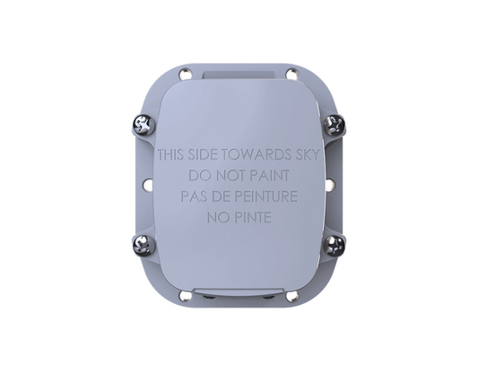
The Globalstar SmartOne C Satellite Asset Tracker provides a simple, reliable way to monitor valuable assets beyond conventional mobile coverage. Using the Globalstar satellite network, it combines GPS location tracking with configurable reporting, motion detection and movement alerts to help you keep tabs on vehicles, trailers, containers, machinery and remote equipment.
Compact, rugged and designed for long-term deployment, the SmartOne C can operate from external power or standard AAA lithium batteries, making it a flexible and cost-effective solution for remote asset tracking and security.
Designed for the intelligent management of fixed and mobile assets, the SmartOne C is a practical solution for a multitude of options including:
- 12 different reporting times
- Interval or 24-hour operation mode
- Alternate reporting scheduling
- Low battery message
How it works:
Tracking with Clear Line of Sight
With a clear line of sight to the sky, the SmartOne C uses motion sensors, comparative GPS positioning and custom-configured sensors to gather and transmit information such as movement and location reports, stop/start messaging and theft recovery alerts using Globalstar's regional simplex satellite network. In addition to positional information, the SmartOne C transmits other message types that include battery status, input alarm status and diagnostic information.
Configuration
Each SmartOne C is configured to track its asset's specific needs and provide intermediate and emergency alerts by email and/or text (when used in conjunction with GTC's mapping portal, www.gtctrack.com). The SmartOne C is configured using a computer and USB connection cable and the configuration software offers a wide range of customisable configuration options such as message frequency, movement and motion sensitivity levels and geo-fencing capabilities. This requires the SmartOne C Configuration cable.
Messaging
Your tracking device cannot operate without a messaging plan. GTC offers four subscription plans (Standard Plan, Light Plan, Heavy Plan and Unlimited Plan). Additionally, to receive messages a mapping portal is required. We offer an add-on GTCTrack service or using your own corporate server is available with a one-off fee. Please note that you must choose one of the mapping options mentioned to receive messages via email.
GTCTrack Compatible
Our online mapping portal can track your SmartOne C tracker to provide real-time information via your GPS location. Any person provided with the login can become an operator to monitor any number of GSM or satellite assets simultaneously in real-time and historically.
Key benefits include:
- Geo-Fencing capabilities (Professional Plan only)
- Alert options available, with varying degrees of urgency for operator and device holder
- Global Tracking
- Multiple layer options and map views
- Inclusive to all devices with GPS tracking capabilities
- Past-tracking data points are always accessible, until the device is de-activated
- Mapping and asset grouping customisation options are available
- Data Reporting and Scheduling functions
- Notifications and alerts can be sent directly to the holder of the device
Allows you to track multiple devices on the same map. Essential for businesses or organisers managing multiple devices.
- Suitable for users with multiple devices under one login
- Includes Geo-Fencing
| SmartOne Plans |
Standby Plan |
Light Plan |
Entry Plan |
Heavy Plan |
Unlimited Plan |
| Minimum Term |
1 Month |
1 Month |
1 Month |
1 Month |
1 Month |
| Activation Fee |
$40.00 |
$40.00 |
$40.00 |
$40.00 |
$40.00 |
| Monthly Fee |
$5.00 |
$14.50 |
$17.50 |
$19.95 |
$30.00 |
| Inclusive Messages |
0 |
100 |
200 |
300 |
Unlimited |
| Additional Message Cost |
$0.25 |
$0.25 |
$0.15 |
$0.15 |
n/a |
| Mapping Plan Name |
Monthly Plan |
| GTCTrack Professional Mapping Plan |
$7.50 / per month |
ALL PRICES EX VAT
*No roll-over of unused messages is permitted from one billing period to the next.
*Subject to fair usage policy (minimum message transmission frequency every 30 mins)
SMARTONE SATELLITE TRACKER – MESSAGE DELIVERY OPTIONS AND FORMATS
Before we can activate your SmartOne Satellite Tracker you must select a GTC messaging plan and a message delivery route. The messaging plan allows your SmartOne tracker to transmit its GPS coordinates and other data to your selected destination.
View SmartOne Airtime and Messaging Plans.
In order to view the GPS coordinates and other information transmitted from the device on a mapping portal, or receive them at a server or by email, you must also select one of the delivery options below:
- GTCTrack
- Deliver raw data to corporate server
- Deliver decoded messages by email
- Deliver decoded messages to a URL
Click here to download full details of the above messaging options.