Your cart is empty


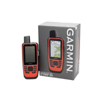


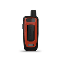
Garmin GPSMAP 86i
Part Number: 010-02236-01
£466.99(Inc. VAT)
£389.16(Ex. VAT)
£389.16(Ex. VAT)
Stay in touch with the new Garmin GPSMAP 86i satellite communicator, with inReach technology and two-way text messaging via the 100% global Iridium® satellite network (satellite subscription required).
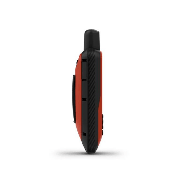
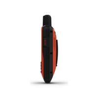
Cast off confidently with the new GPSMAP® 86i marine handheld from Garmin. Whether you’re out for a day of fishing, sailing or cruising, have peace of mind with this backup navigator with satellite communication and interactive SOS. This premium handheld floats and has a sunlight-readable 3” colour display. Plus, wireless connectivity makes it a virtual extension of your onboard marine system, giving you added awareness and convenience.
Garmin 86i Key Features:
Designed for Marine Environments
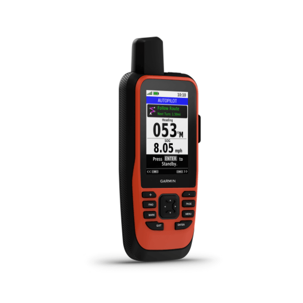
The Garmin 86i GPS handheld has water resistance and floating technology. Additionally, this tracking device can become a remote control for convenient operation of your Garmin autopilot and select FUSION® marine products
Display
The sunlight-readable 3" display and button operation provide ease of use on the water.
Tracking
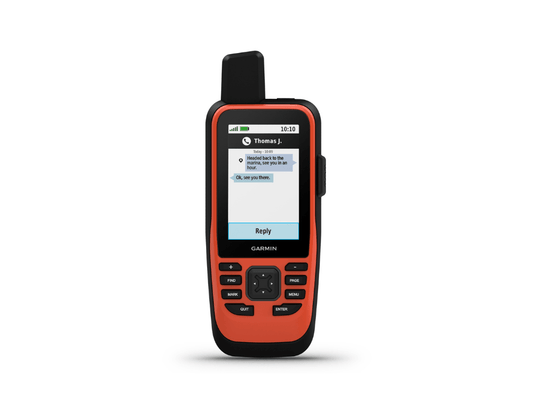
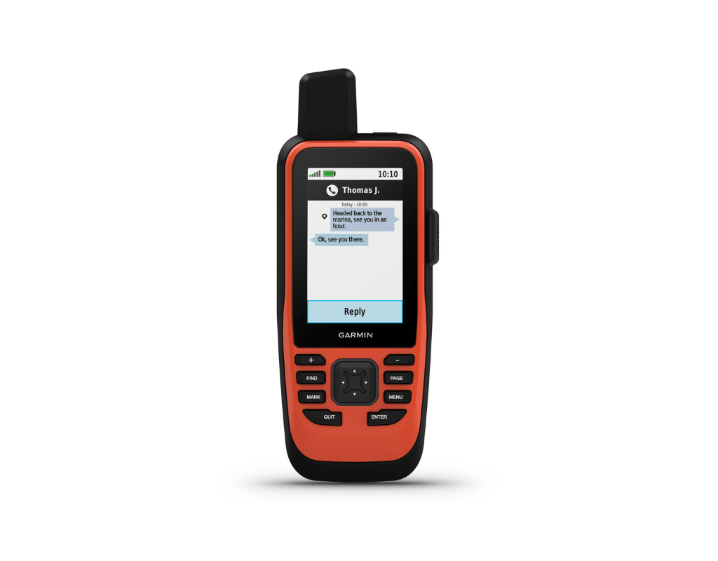
The GPSMAP 86i has live location tracking so every time minutes your location is sent to your MapShare page, for your friends and family to follow your trip. Additionally, those with access to your MapShare page can ping you and send messages to your device, in near real time. The tracking setting can be customised, decreasing the tracking interval will conserve the battery life of your tracker.
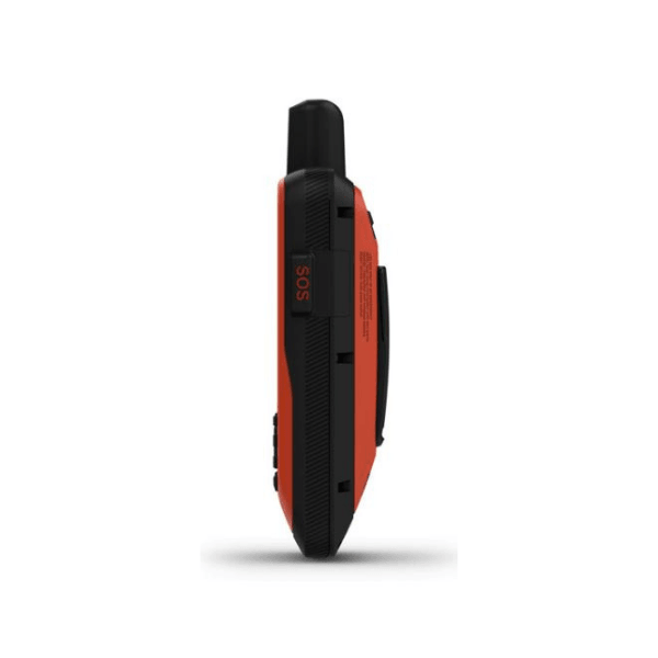
Interactive SOS button
The SOS button, located on the right-hand side of the Garmin 86i tracker, enables you to trigger an emergency SOS signal to the International Emergency Response Coordination Center (IERCC), a 24/7 emergency monitoring and response centre.
Navigation
TOPO maps are preloaded with the Garmin 86i tracker, as well as the ability to download high-resolution BirdsEye aerial imagery directly to the device using the built-in Wi-Fi. These navigation capabilities allow you to calculate precise road and trail routes, as well as leave a breadcrumb trail (which would allow you to safely navigate back the way you came). Use the Garmin Explore website and app as a companion to help you manage waypoints, routes and activities, review trip data from the field, and sync info across devices.
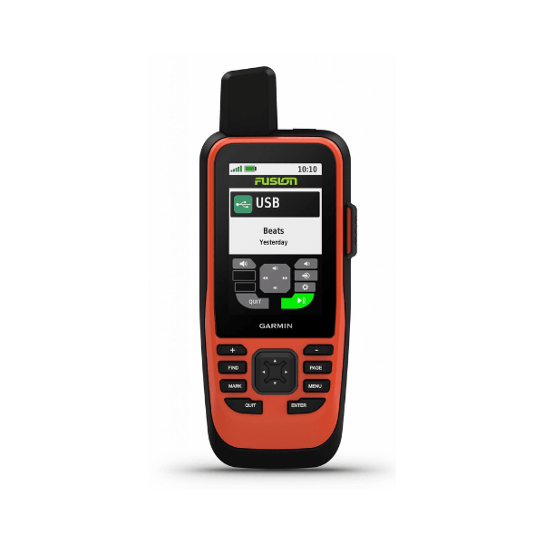
Stream Boat Data
The new Garmin satellite communicator enables users to stream boat data from compatible chartplotters* and instruments to consolidate your marine system information.
inReach Technology
The Garmin 86i tracking device uses inReach satellite communication technology to enable two-way text messaging via the 100% global Iridium® satellite network (satellite subscription required). You can also receive marine weather forecasts directly on your device, so you can make educated decisions based on local conditions or the destination ahead.
Connect with your boat
Sync GPSMAP® 86i with compatible Garmin chartplotters* and instruments and you’ll see real-time boat data displayed right on your handheld. Plus, it can serve as a remote control for convenient operation of your Garmin autopilot and select FUSION marine products. When you’re underway, an adjustable GPS filter smooths speed and heading indications over swells for more accurate tracking.
Stay in Touch
Get smart notifications right on your GPSMAP® 86i handheld when you pair it with your compatible smartphone. You can also sync GPSMAP® 86i with the Garmin Explore™ portal and app for cloud management of your favourite waypoints, tracks and routes. GPSMAP® 86i offers Wi-Fi® connectivity, ANT+® technology and Bluetooth® wireless technology for easy wireless updates and connections.
FAQs
What is Garmin inReach?
Garmin inReach is a satellite communication device that allows users to send and receive messages, share their location, and trigger an SOS in case of emergency, even when outside of mobile coverage.
Do I need a subscription to use Garmin inReach?
Yes, a subscription is required for Garmin inReach devices to access satellite communication features, including messaging, SOS, and tracking.
Can I pause or suspend my inReach plan?
Garmin inReach plan can be suspended for just £4.99 per month.
What is included in the Garmin inReach subscription?
Depending on the plan, features include:
- Two-way text messaging via the Iridium satellite network
- Location tracking and sharing
- SOS emergency response (via GEOS)
- Weather forecasts
- Basic or unlimited preset messages
- Voice notes and images (on inReach Messenger Plus only)
How do preset messages work, and are they unlimited?
Preset messages are pre-written messages you can send to specified contacts. Many plans allow unlimited preset messages but may limit custom two-way messaging.
How does the SOS feature work?
Pressing the SOS button will trigger an emergency response through the International Emergency Response Coordination Center (IERCC), which contacts local rescue services and provides two-way messaging.
Can I change the tracking interval on the device?
Yes, this can be updated on the device and the intervals available depend on the plan you are active on. Please note on some plans, the more track points you send overage charges may apply.
What happens if I exceed my message or tracking limit?
- Additional messages beyond the plan’s limit may incur extra charges.
- Some plans have unlimited tracking and messages, while others have limits.
Can I use inReach outside my home country?
Yes! Garmin inReach works globally via the Iridium satellite network, but messaging costs remain the same regardless of location.
Does inReach work without a mobile signal?
Yes! Garmin inReach devices use satellite communication, making them fully functional in remote locations with no mobile signal.
Can I use inReach to call instead of text?
No, Garmin inReach does not support voice calls. It only allows text messaging and emergency SOS. However, the Garmin inReach Messenger Plus allows users to send and receive voice notes over satellite.
Does Garmin inReach require a separate SIM card?
No, inReach uses an internal satellite modem that works with Garmin's subscription plan. No SIM card is needed.
Are there any restrictions on where an inReach can be used?
Yes, we always advise checking with a country's embassy before travelling. Without an inReach, you will not be allowed to travel to countries such as India, Cuba, North Korea, and Burma.
*Compatible Garmin chartplotters include: GPSMAP® 1022, GPSMAP® 1222, GPSMAP® 1222 Touch, GPSMAP® 1222xsv Touch, GPSMAP® 722, GPSMAP® 722xs, GPSMAP® 7407, GPSMAP® 7407xsv, GPSMAP® 7408, GPSMAP® 7408xsv, GPSMAP® 7410, GPSMAP® 7410xsv J1939, GPSMAP® 7412, GPSMAP® 7412xsv, GPSMAP® 7416, GPSMAP® 7416xsv, GPSMAP®8417 MFD, GPSMAP® 8422 MFD, GPSMAP® 8424 MFD, GPSMAP® 922, GPSMAP® 922xs